Travel Western North Carolina
Motoring through the Mountains - 1930s: Mt. Mitchell
As automobile transportation became more feasible in western North Carolina, new means of accessing the region’s scenic beauty were devised. Tourist centers, such as Asheville, provided both local residents and visitors the opportunity to enjoy a day trip to a variety of locations, such as Mt. Mitchell and Roan Mountain as featured on this page. At an elevation of 6,684 feet, Mt. Mitchell in Yancey County is the highest summit east of the Mississippi River and has long been a favorite tourist destination.
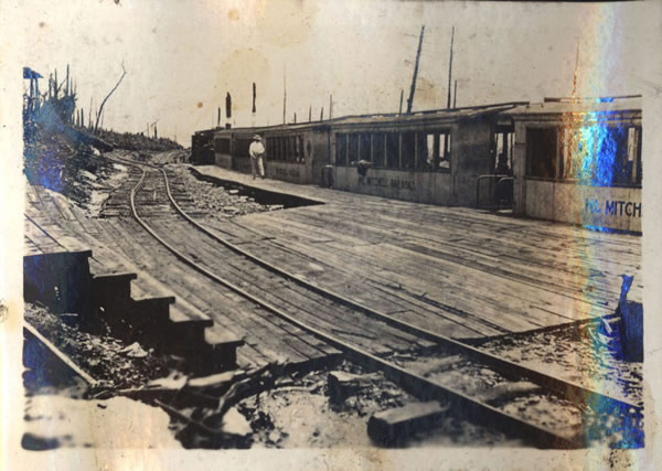
In the 1910s a logging railroad on Mt. Mitchell had evolved into use as a scenic line for tourists, as seen in this photograph with a handwritten title “Railroad station top of Mt. Mitchell.” In 1921 the rail line was replaced by an automobile toll road that ran from the town of Black Mountain to Camp Alice near the summit of Mt. Mitchell.
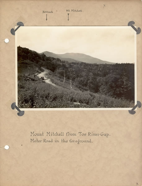
“Mount Mitchell from Toe River Gap”
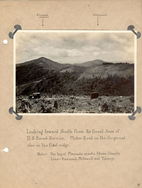
“Looking Toward South from Re-Forest Area”
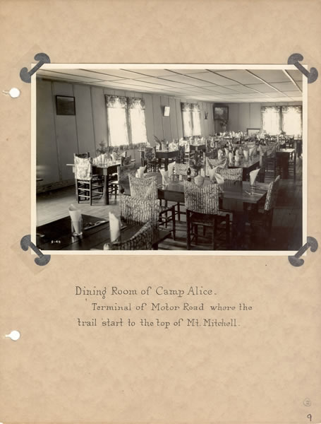
“Dining Room of Camp Alice”
About 1924, George Masa (1881 – 1933) took a series of photographs for a photo album entitled “Mount Mitchell and Views – Along Mt. Mitchell Motor Road.” Masa, a native of Japan, settled in Asheville in 1915 and opened a photography studio in the early 1920s. These examples from the photo album feature the motor road and include handwritten captions of prominent physical features.
The brochure Asheville, Where to Go provided readers with a description of the trip to Mt. Mitchell and the toll road. In a loop drive encompassing 91 miles, the traveler could go to the town of Black Mountain and, upon paying the entrance fee of $1.00 per person or $3.00 per car, proceed up the road. A different route for scenic diversity was available, for an additional 50 cents per person, by way of the “Big Tom Wilson” road. The brochure noted that,
“Camp Alice, near the summit, provides meals and tourist accommodations. . . . Both routes to Mt. Mitchell are one way roads from entrance gates to top. Hours for ascent 8:30 a.m. to 1:00 p.m.; descent 3:00 p.m. to 5:30 p.m. Special arrangements for night ascent.”
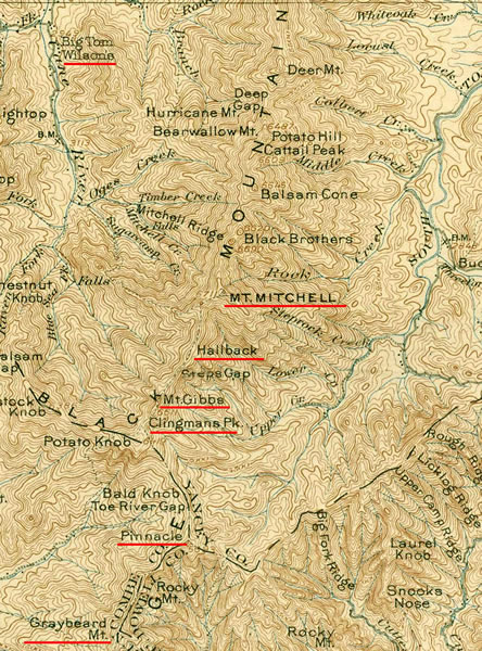
This section from the “Mount Mitchell Quadrangle” topographic map, issued in 1902 and reprinted in 1920, highlights physical features mentioned in Masa’s captions to his photographs of the motor trip to Mt. Mitchell.
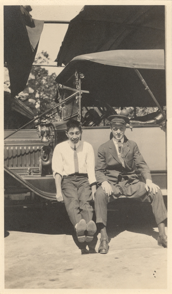
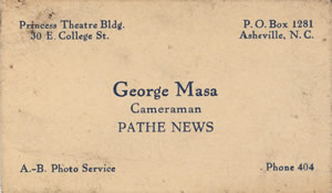
George Masa (left) with an unidentified chauffeur. Masa’s business card.
An Automobile & Hiking Trip to Roan Mountain
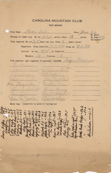
This “trip report” of a Carolina Mountain Club excursion to Roan Mountain notes that the trip by car from Asheville was 123.8 miles, with an additional 18 miles covered by foot. Roan Mountain, located in both North Carolina’s Mitchell County and in Tennessee, is noted for its rhododendrons.
 |
Return to the Map for the 1930s
Sources & Readings
- Department of the Interior, U.S. Geological Survey. “Mount Mitchell Quadrangle.” Edition of March 1902, reprinted 1920.
- Hart, William A., Jr. “George Masa: The Best Mountaineer.” In Robert S. Brunk, May We All Remember Well: A Journal of the History and Cultures of Western North Carolina. Volume 1. Asheville, N.C.: Robert S. Brunk Auction Services, Inc., 1997. pp. 249 – 275.
- Lovelace, Jeff. Mount Mitchell: Its Railroad and Toll Road. Johnson City, Tenn.: Overmountain Press, 1994.
- Poole, Cary Franklin. A History of Railroading in Western North Carolina. Johnson City, Tennessee: Overmountain Press, 1995.
- Powell, William S. The North Carolina Gazetteer. Chapel Hill: University of North Carolina Press, 1968.
- Silver, Timothy. Mount Mitchell and the Black Mountains: An Environmental History of the Highest Peaks in Eastern America. Chapel Hill: University of North Carolina Press, 2003.
- Swannanoa Valley Museum. Black Mountain and the Swannanoa Valley. Charleston, S.C.: Arcadia, 2004.