Travel Western North Carolina
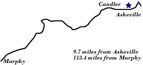
Motoring through the Mountains - 1930s: Candler
Buncombe County
Altitude: 2,120 feet
The National Forests of the Southern Appalachians, August 1923
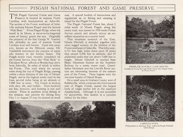
“Pisgah National Forest and Game Preserve”
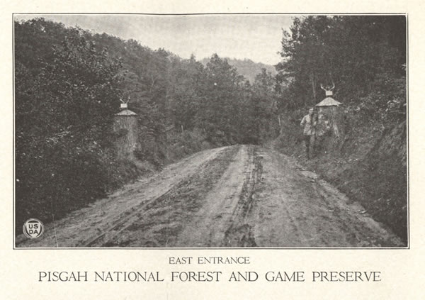
East Entrance, Pisgah National Forest
As automobile travel became more commonplace, efforts were made to provide vacationers with improved or new roads and with travel information. Mt. Pisgah had been a prominent and noted scenic destination in western North Carolina for decades. In 1914 the United States purchased the mountain and thousands of acres of forest lands that the late George Vanderbilt had assembled as part of his immense Biltmore Estate. In 1916 Pisgah National Forest was established. In a travel brochure entitled The National Forests of the Southern Appalachians (Washington, D.C.: United States Department of Agriculture, August 1923), Pisgah National Forest was one of the featured gems. The brochure noted that, “The National Forests of this group are readily accessible to millions of people over main automobile highways, or over the lines of the Southern Railway, Baltimore & Ohio Railroad, and other systems” (p. 6). In addition to accessibility, the brochure indicated that
“The Pisgah motor road, recently completed by the Forest Service from the `Pink Beds’ to Davidson River, affords a 90-mile-loop drive from Asheville, 26 miles of which is within the Forest. This road winds for several miles along the top of Pisgah Ridge, passing within a short distance of the top of Mount Pisgah, and is the highest scenic road in the East, several miles being at an altitude of 5,000 feet or more.” (p. 16)
The “Pink Beds” mentioned above may refer to an area in Pisgah National Forest that had become renowned for its flowering foliage.
Another brochure -- Asheville, Where to Go -- listed Mt. Pisgah and the automobile routes around the mountain as a leading destination in the Asheville area. The brochure recommended to motorists that they drive the twenty-seven miles to Candler in order to see:
“One of the most popular mountains of Western North Carolina and the center of the Pisgah National Forest, formerly a part of the Biltmore Estate, . . . . Follow N.C. 10, going west through West Asheville, pass American Enka rayon plant to Candler. Turn left following paved highway up Hominy Creek Valley. Two-way all-weather gravel road up mountain.”
 |
||
Return to the Map for the 1930s
Sources & Readings
- Asheville Chamber of Commerce. Asheville, “In the Land of the Sky”: Where to Go, What to Do, What to See. Asheville Chamber of Commerce. N.d.
- Powell, William S. The North Carolina Gazetteer. Chapel Hill: University of North Carolina Press, 1968.
- Swaim, Douglas, ed. Cabins & Castles: The History & Architecture of Buncombe County, North Carolina. City of Asheville, County of Buncombe: Division of Archives and History, North Carolina Department of Cultural Resources, 1981.
- United States Department of Agriculture, Forest Service. The National Forests of the Southern Appalachians: What They Mean to the East and South. (Washington, D.C.: United States Department of Agriculture, August 1923)