Travel Western North Carolina
Following Wagon Trails - 1890s: Hazelwood
Haywood County
Altitude: 2,725 feet
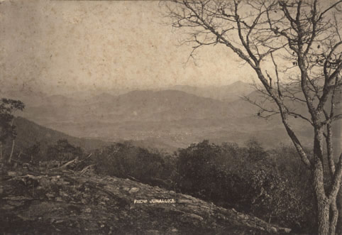
This photograph, entitled “From Junaluska,” dramatizes the views available from mountain peaks located above the Hazelwood and Waynesville vicinity. According to the North Carolina Gazetteer, Junaluska Mountain would also be known as Eaglenest Mountain, a reference to the popular Eaglenest Hotel that was built atop the mountain in 1902. At an elevation of over 5,000 feet – some 2,300 feet above the valley below -- the hotel became renown for its dramatic views and bracing air.
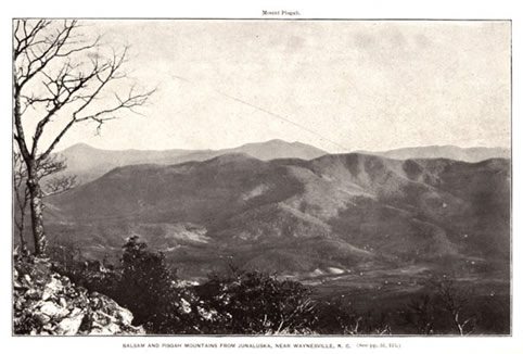
The 1902 report issued by the U.S. Department of Agriculture as report Forests, Rivers and Mountains of the Southern Appalachian Region featured this picture entitled “Balsam and Pisgah Mountains from Junaluska, Near Waynesville, N.C.” In addition to the main caption at the bottom, Mount Pisgah is identified at the top of the picture.
 |
||
Return to the Southern Railway Map for the 1890s
Sources & Readings
- Allen, W.C. (William Cicero). The Annals of Haywood County, North Carolina: Historical, Sociological, Biographical, and Genealogical. [S.l.: S.n.], 1935.
- Haywood County Heritage Book Committee, ed. Haywood County Heritage, North Carolina, 1994. Waynesville, N.C.: Published by the Haywood County Genealogical Society, in cooperation with Walsworth Publishing Co., 1994.
- Jarrett, Dana L, ed. A Pictorial History of Haywood County. Asheville, N.C. Asheville Citizen-Times Pub. of North Carolina, 1994.
- Powell, William S. The North Carolina Gazetteer. Chapel Hill: University of North Carolina Press, 1968.